By Johnathan Paoli
A powerful cold front sweeping across the country is unleashing heavy rains, biting winds and snowfall across multiple provinces, plunging temperatures and triggering widespread weather warnings as emergency services brace for escalating disruptions.
The South African Weather Service (SAWS) has issued multiple warnings for snow, torrential rain, and gale-force winds that are expected to continue through Friday.
According to SAWS meteorologist Lehlohonolo Thobela, the cold front made landfall in the Western Cape early Wednesday, bringing heavy rainfall that is already causing localised flooding.
“We have a yellow Level 2 warning for disruptive rain and expect light snow in high-lying areas of the Western Cape and southern Namakwa District. Very cold overnight temperatures are expected in areas such as Sutherland, while damaging winds and high waves will affect coastal and inland regions,” Thobela said.
These conditions have already begun affecting large parts of the Western and Northern Cape and are now spreading eastward to the Eastern Cape, Free State, and Gauteng.
In Langa, Cape Town, residents are already feeling the impact.
Torrential rain has begun to flood informal settlements, and residents have been seen digging makeshift trenches to prevent water from entering homes.
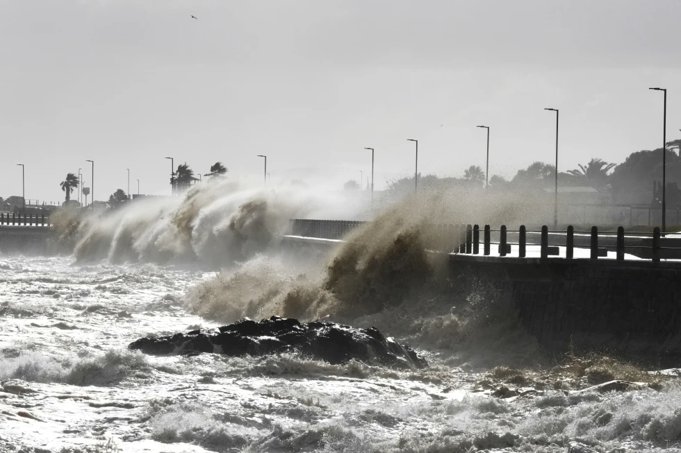
SAWS has issued a Yellow Level 4 warning for damaging waves between Alexander Bay and Plettenberg Bay.
High-sided vehicles and small boats have been advised to avoid travel as gale-force winds up to 70 km/h sweep across the southern coastline.
Further inland, winds of 40–50 km/h are disrupting travel and transport across the Free State and Northern Cape.
Cold and stormy conditions are expected across three major provinces.
The Western Cape will experience scattered to widespread rain, strong south-westerly winds, and light snow on mountain peaks, with disruptive flooding in the Cape Winelands, Overberg and Cape Town metro areas.
The Eastern Cape will see damaging coastal winds and light snowfall expected in areas like Barkly East and Senqu.
Thobela warned that although rain was less severe, icy roads may pose risks for motorists.
Cold to very cold temperatures with scattered showers are expected in the western and southern parts of the Northern Cape, with light snow likely over higher terrain in the Namakwa district.
Meanwhile, Gauteng residents are advised to prepare for a sharp temperature drop from Thursday night, with minimum temperatures expected to dip to -2°C in southern parts of the province.
Maximum temperatures will hover around 14–15°C through the weekend.
Amid the worsening weather, Eskom’s latest data shows that average unplanned outages have climbed to 13,211 MW over the past seven days.
This exceeds the utility’s 2024/25 Winter Outlook threshold needed to avoid load-shedding and raises concerns that electricity supply may not keep pace with increased winter demand for heating and lighting.
Eskom has yet to announce formal load-shedding, but urged citizens to reduce consumption, particularly during peak hours in the morning and evening.
Cooperative Governance and Traditional Affairs Minister Velenkosini Hlabisa said earlier in the day that the government was on high alert.
He called on all residents, particularly in flood-prone and coastal areas, to take safety precautions, heed weather alerts and avoid unnecessary travel.
The minister said that emergency teams have been activated to monitor and respond swiftly.
He warned that navigation at sea could be extremely dangerous due to wave heights between 5.5 and 7.5 metres, especially along the Western and Northern Cape coastlines.
As the cold front extends into the Eastern Cape, the province continues to recover from previous floods that killed at least 101 people.
Search and rescue teams are still trying to locate missing individuals as communities rebuild destroyed homes and damaged infrastructure.
The weather service has cautioned that while new rainfall in the Eastern Cape is not expected to be severe, damaging winds and icy conditions could pose new risks.
In addition to the severe cold, SAWS has issued a Yellow Level 1 warning for disruptive snow in the Eastern Cape’s Senqu and Elundini municipalities and extreme fire danger warnings for parts of Mpumalanga and Limpopo due to dry, windy conditions ahead of the front’s arrival.
As the cold front pushes eastward, temperatures across the Free State, North West, Limpopo and Mpumalanga are also expected to drop.
Isolated thundershowers, icy roads, and high wind speeds may continue to affect these provinces through the weekend.
With adverse conditions likely to linger into early next week, government departments, Eskom and disaster response teams are on standby and South Africans are being urged to stay indoors, remain updated via official channels and extend support to vulnerable communities.
INSIDE POLITICS

