By Lebone Rodah Mosima
The South African Weather Service (SAWS) has issued multiple weather warnings for Monday, with disruptive rain, severe thunderstorms, damaging winds and rough seas expected across several provinces.
A Yellow Level 4 warning for disruptive rain is in place over eastern Namakwa in the Northern Cape and the Central Karoo District of the Western Cape, where flooding of roads and settlements and major traffic disruptions are possible.
The warning came into effect at 18:00 on Sunday, 13 September, and remains valid until 23:59 on Monday.
SAWS said a cut-off low-pressure system developing west of the country was expected to affect the Western and Northern Cape from Sunday into Monday.
“The public and small stock farmers are advised that intermittent showers and thundershowers accompanied [by] heavy downpours at times with possible large amounts of small hail and lightning, significant drop in temperatures over high-lying areas, windy coastal and interior conditions as well as very rough seas (reaching 4.0 to 4.5 m south of Table Bay),” SAWS said.
ALSO READ: Ramaphosa: BRICS can help build a fairer world and a stronger SA economy
Rainfall accumulations of between 25mm and 50mm are expected over eastern Namakwa and the Central Karoo through Monday, with between 60mm and 80mm possible in some areas.
A Yellow Level 2 warning for severe thunderstorms is also in place on Monday over the Nama Khoi and Kamiesberg municipalities of the Northern Cape and the West Coast, Cape Winelands and Overberg districts, as well as the City of Cape Town.
The storms could bring excessive lightning, resulting in localised injuries to people and livestock and disruptions to services due to power outages.
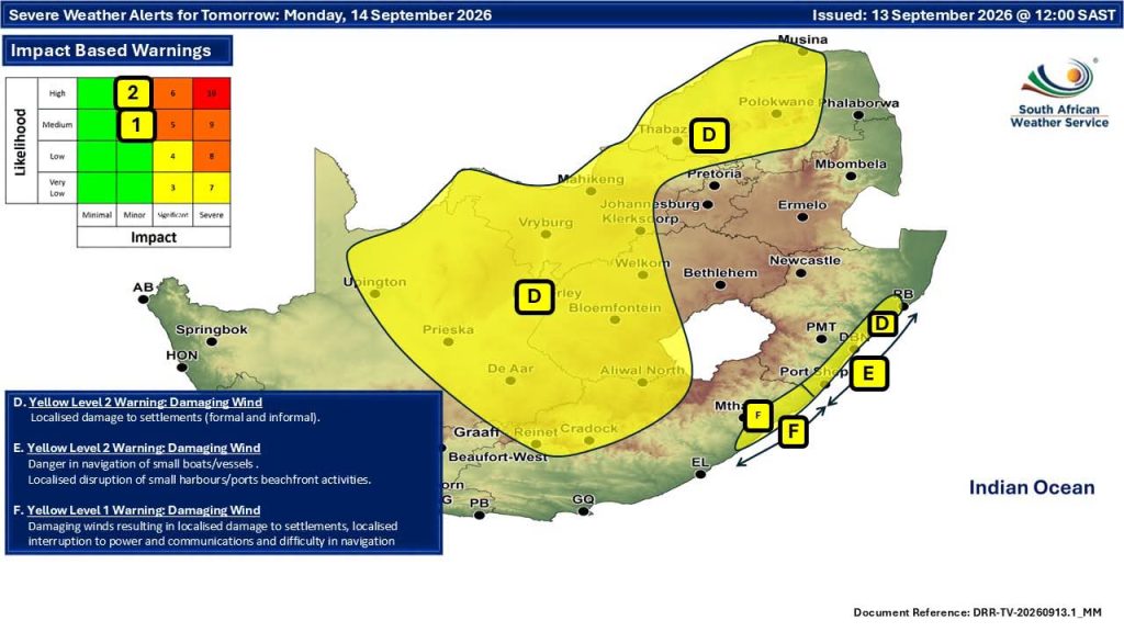
In the Eastern Cape, a Yellow Level 1 warning for severe thunderstorms is in place on Monday along parts of the north-eastern coast and adjacent interior. The storms could cause localised damage to settlements and temporary structures and disruptions to power and communication services.
Strong winds are also expected across large parts of the interior on Monday.
SAWS has issued a Yellow Level 2 warning for damaging winds over North West, eastern parts of the Northern Cape, central and western parts of the Free State, central and western Limpopo and parts of the northern Eastern Cape.
The winds could damage informal settlements and disrupt power and communication services.
ALSO READ: Cosatu affiliates square off over federation’s top jobs
Along the KwaZulu-Natal coast, a Yellow Level 2 warning for damaging winds and waves is in place between Port Edward and Richards Bay and the adjacent interior on Monday.
The conditions could result in temporary disruption at small harbours and ports, difficulties for vessels navigating at sea and localised damage to infrastructure and settlements.
A Yellow Level 1 warning for damaging winds is also in place on Monday over parts of the extreme north-eastern Eastern Cape coast and adjacent interior, with localised damage and power and communication disruptions possible.
SAWS has also warned of extremely high fire danger conditions over western parts of the Waterberg District and the Blouberg municipality in Limpopo on Monday.
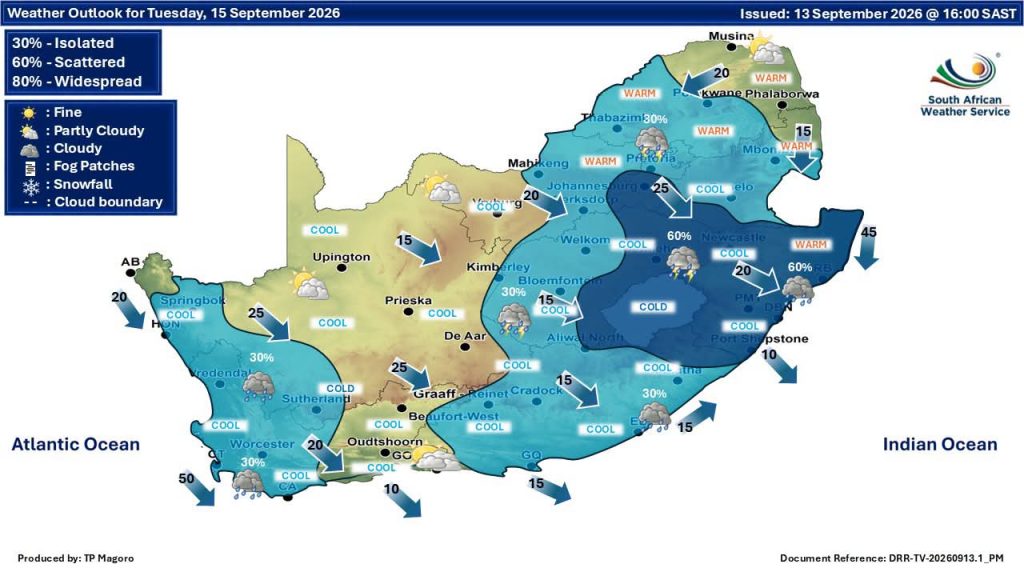
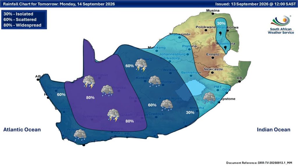
Elsewhere, Gauteng will be partly cloudy and cool to warm on Monday, with isolated showers and thundershowers.
North West and the Free State will be partly cloudy, windy and cool to warm, with scattered showers and thundershowers. The showers will be isolated in eastern North West and the north-eastern Free State.
The Northern Cape is expected to be cloudy, windy and cool to cold, with scattered showers and thunderstorms becoming widespread over central and eastern areas, while the Western Cape will be cloudy and cool to cold with scattered thunderstorms and widespread activity over the north-east.