

By Lebone Rodah Mosima
Severe thunderstorms, flooding, hail and damaging winds are expected across parts of South Africa on Monday before conditions begin improving from Tuesday, and much of the central and eastern interior dries out from Wednesday.
The South African Weather Service (SAWS) has issued an Orange Level 6 warning for severe thunderstorms on Monday covering most of North West, the northern half of the Free State and parts of the north-eastern Northern Cape.
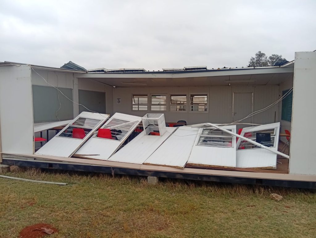
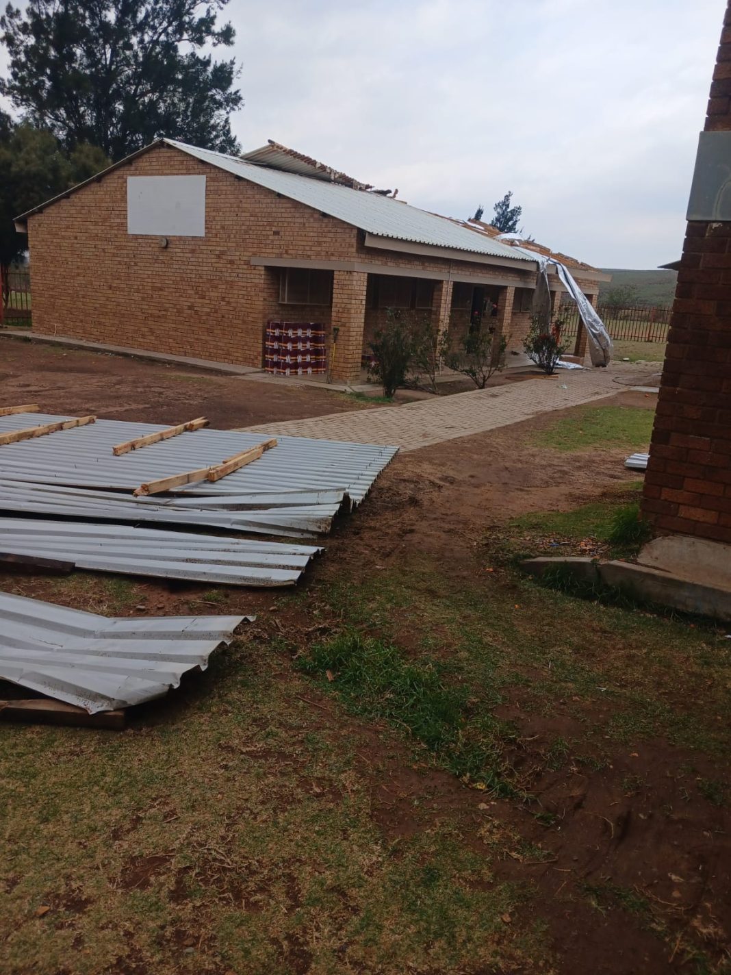
Heavy rain, strong winds, hail and excessive lightning could lead to flooding of roads, settlements and low-lying areas, damage to homes and infrastructure, disruption to municipal services and hazardous travelling conditions.
An Orange Level 5 warning is in place for Gauteng and the Highveld of Mpumalanga, where similar conditions, including flooding, strong gusty winds and hail, are possible.
ALSO READ: ANALYSIS | New White Paper, new funding model: can SA reset local government?
Further Yellow Level warnings cover parts of the Northern Cape, Free State, North West, Limpopo and Mpumalanga, while damaging winds are also possible along parts of the Western Cape coastline.
KwaZulu-Natal is expected to remain cloudy and cold to cool on Monday, with scattered showers and thundershowers across much of the province.
The eastern parts of the Eastern Cape will also experience cloudy and cool conditions, with rain and showers possible, while the western parts of the province should be somewhat drier.
The Western Cape is expected to escape much of the heavy rainfall affecting the interior, although SAWS has warned of potentially damaging winds along parts of the coast.
ALSO READ: WATCH LIVE| SAPS commemoration day for officers who died in the line of duty
Conditions should begin improving on Tuesday as the cut-off low-pressure system responsible for the unsettled weather moves eastwards.
SAWS forecaster Lehlohonolo Thobela said thunderstorms were expected to become more isolated over Gauteng, Mpumalanga, KwaZulu-Natal and Limpopo on Tuesday.
By Wednesday, SAWS expects the central and eastern parts of the country to be largely dry, marking a significant change after several days of widespread rainfall and thunderstorms.
Conditions should remain considerably more settled on Thursday and Friday across Gauteng, North West, the Free State and much of the eastern interior, with temperatures recovering as the cold and wet system moves away.
The latter part of the working week is therefore expected to bring generally milder and drier spring conditions to much of the country, although isolated showers may remain possible in some eastern areas.
ALSO READ: Afrika Mayibuye names ‘Skeem GP’ as Ekurhuleni mayoral candidate
In Johannesburg, Emergency Management Services has urged residents to continue exercising caution when using heaters, paraffin stoves, braziers and imbaulas while cold conditions persist.
City of Johannesburg EMS spokesperson Robert Mulaudzi urged people using braziers or imbaulas to ensure they were used in well-ventilated areas and removed before going to sleep.
“Our residents are also encouraged to look after heating devices like heaters and paraffin stoves, and not to leave them unattended while in use so that we can be able to prevent fire incidents which might occur at homes during this extremely cold temperatures,” Mulaudzi said.
“From our side, the City of Johannesburg Emergency Management Services remains on high alert, monitoring all seven regions of the city for any emergencies which might occur.”
Residents were urged to report life-threatening emergencies to the City of Johannesburg’s emergency call centre on 011 375 5911.